
Okay...I must admit that there's not a lot of things in life that really intimidate me. My list includes:
1) Spiders
2) Heights
3) Incredibly sexy women
4) Cleaning the grout in a mildew-laden shower
Well...I think I'm about ready to add a fifth item to my list: silly-long bike rides!!! The Colorado Death Ride, the second event of the 2011 Colorado Triple Crown Series, could be considered as such a ride! Here's the skinny on next weekend's event:
1) At 225 miles, the Colorado Death Ride is the longest double century event on the UltraMarathon Cycling Association (UMCA) UltraCycling Cup calendar and arguably the hardest single-day event on the RMCC calendar.
2) The Death Ride has LOTS of climbing! The total vertical gain for the Death Ride has remained somewhat elusive over the years. Some sources have estimated the San Juan Skyway to have over 15,000 feet of vertical gain. Other sources have estimated the loop to have 20,000 feet of vertical gain. The exact amount of climbing probably lies somewhere in between. The Death Ride climbs over three mountain passes that exceed 10,000 feet in elevation and one pass that exceeds 11,000 feet! No other event on the UMCA calendar has so many individual climbs that expose riders to high altitude!
3) The Death Ride has jaw-dropping mountain scenery that is second-to-none! The San Juan Mountains are frequently one of the most-photographed regions in the state of Colorado. After riding this route, you will understand why this is the case. Be sure to keep your digital camera in your jersey pocket. You'll definitely want to have it on this ride!

General Information:
1) Ride Date: Sunday, July 3, 2011
2) Host Hotel/Start and Finish Location: Ridgway Lodge and Suites, 373 Palomino Trail, Ridgway, CO. Phone: 970-626-5444.
3) Ride start/check-in: Rider check-in at 1:30 am in the motel lobby. Ride start at 2:00 am. Yes...this is an early start, but we want participants to finish the ride during the daylight hours, especially on a holiday weekend. Consider setting two alarm clocks as this can be an easy start to miss! Lights and reflective gear are required!
4) Official support vehicles: We will have one support vehicle to SAG this ride, which will be driven by Charlie Henderson and Jim Kraychy (Charlie's cell phone: 720-480-9714). Participants riding without private SAG support should plan to use this support vehicle to transport gear bags. These gear bags will be accessible at checkpoints along the course. Participants riding with private SAG support should notify Charlie prior to the start of the ride that they will have support from family or friends. Riders with private SAG support may be asked to support other riders.
5) Time limits: Please keep in mind that this is a timed bike ride! Participants have 19 hours to complete this ride to earn an official finishing time and to receive Colorado Triple Crown credit. Riders can only begin riding at the official start time and must reach all checkpoints before the following time cut-offs to receive an official finishing time: 1) Silverton, 5:00 am, 2) Durango, 8:30 am, 3) Dolores, 12:30, 4) Rico, 3:45 pm. 5) Ridgway, 9:00 pm. If riders are going to leave Rico after 3:00 pm OR ride over the Dallas Divide after 8:00 pm, please call Charlie to let him know!
6) Checkpoints: All riders should plan to have their event passports validated at the following official checkpoints: 1) Silverton, gas station, 2) Durango, Exxon gas station on Hwy 160, 3) Dolores, Dolores Food Market, 4) Rico, Conoco gas station on the left side of CO Hwy 145, 5) Ridgway, Ridgway Town and Suites Motel. Finishers should have their event passports validated by staff at the motel. If Charlie is not present at the finish, you can mail your event card to: Charlie Henderson, 2 Blue Grouse Ridge Road, Littleton, CO 80127.
7) Additonal Support Points: Riders with private SAG support may also receive additional support at these locations: 1) Molas Pass, 2) Lizard Head Pass, 3) Telluride Junction, 4) Sawpit/Placerville, 5) Dallas Divide. Note: The Conoco Station at Telluride Junction can be extremely busy. Please watch for traffic at this support point.
8) Special notes about support: 1) If the weather turns nasty, support can be anywhere! 2) Faster riders may out-run the support vehicle after Dolores and will not be to access their gear bags after leaving this check point. These riders need to plan ahead and bring the supplies and gear that they will need to complete this ride!
9) Abandonment: If you need to abandon the ride for any reason, please call Charlie Henderson at 720-480-9714 as soon as possible to let him know! Additionally, if you are going to leave Rico after 3:00 pm or arrive at Ridgway after 9:00 pm, please call Charlie to let him know! We don't want to spend all night worrying about where you are! Please note that we do not sweep the course!
10) Emergencies: If you have an accident or injury that requires emergent attention, please call 911. Please call Charlie ASAP to let him know!
11) Event Rules: Please review the event rules before the ride on Saturday: http://coloradotriplecrown.blogspot.com/2011/05/rules-regulations-and-safety.html
The Colorado Death Ride can be broken down into five segments:
1) Ridgway to Silverton, 33 miles.

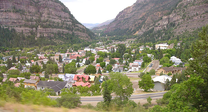
After a very short night of sleep, riders will stumble out of bed as they prepare for the 2:00 am start time. From the Ridgway Lodge and Suites Motel, riders will head south along US Hwy 550 toward the scenic mountain community of Ouray, the northern gateway to the San Juan Mountains.
As riders pass through the town, curious bystanders stumbling home from the pubs and breweries will gawk at the riders who pass quietly down mainstreet in the middle of the night. Approaching the southern end of town, participants will see a narrow mountain road that snakes its way up the side of the mountain into the blackness of the night. This is the start of Red Mountain Pass!

Red Mountain Pass (elev. 11,019 feet) is one of the most notorious mountain passes in Colorado! Known for it's breath-taking views and teeth-chattering drops, this pass is not to be taken lightly! Red Mountain Pass is one of Colorado's classic mountain climbs, gaining 4,100 feet in 23 miles from Ridgeway. As riders grind their way up the mountainside in the darkness, they will hear the sounds of waterfalls crashing hundreds of feet below. They will also notice the air become thinner and colder! Be sure to bring your full selection of winter riding gear as it is not unusual to encounter sub-freezing temperatures at the top of this pass, even on the most pleasant of summer evenings. At the top of the pass (no services), riders will begin an exhilarating but chilly 10 mile, 1,800 foot plunge to Checkpoint #1, Silverton (gas station). A word of caution while riding this segment: Be sure to NOT ride too close to the edge of the road when climbing or descending Red Mountain Pass...there is NO shoulder or guardrail and the drops exceed 1,000 feet in places!
2) Silverton to Durango, 48.3 miles.

From Silverton (elev. 9300 feet), participants will continue riding south on Hwy 550, promptly beginning their next climbing challenge for the day: the Molas Pass-Coal Bank Pass combination. As cyclists depart from the chilly, sleeping town of Silverton, they will begin a short but steep climb up Molas Pass, gaining 1,350 feet in 6 miles. As they climb up the pass, participants will begin to catch the first glimmer of daylight to the east. Surrounded by spectacular snow-capped peaks and serene alpine lakes, participants will begin to appreciate the true grandeur of the San Juan Mountains! Upon reaching the top of Molas Pass (elev. 10,910 feet), Hwy 550 makes a brisk four-mile plunge to the low point between Molas Pass and Coal Bank Pass (elev. 9800 feet). Participants will then climb three moderate miles to the top of Coal Bank Pass (elev. 10,640 feet).

From the top of Coal Bank Pass, participants will begin the long, often exhilarating 4,100 foot descent toward the town of Durango. As riders pick up steam down the pass, they can imagine themselves racing the Durango and Silverton Narrow Gauge Railroad Train (in the opposite direction), as bike racers do every Memorial Day weekend during the Iron Horse Classic, one of Colorado's longest standing bicycle races. After passing Cascade Village at the bottom of Coal Bank Pass, riders will continue along the Million Dollar Highway (Hwy 550) as it rolls past the Durango Mountain Resort, opulent mountain homes, and plush groves of aspen.

Hwy 550 will then make a final plunge toward the community of Hermosa. A word of caution: be sure to ride across the railroad tracks in Hermosa with caution as they cross the road at an awkward angle. These tracks have been known to take out a cyclist or two! From Hermosa, participants will continue riding south along Hwy 550 for ten relatively flat miles to the town Durango (elev. 6512 feet, full services). Durango is one of Colorado's outdoor meccas, attracting thousands of tourists throughout the year for a variety of activities, including camping, hiking, rafting, skiing, and mountain biking. It is also home to several of Colorado's cycling legends, including Tom Danielson, Ned "The Lung" Overend, and Todd Wells. Unfortunately, participants won't be able to spend much time "playing" in Durango as they still have a long day on the bike ahead of them! From Durango, participants will turn west (right) onto US Hwy 160 and ride approximately 1.2 miles to Checkpoint #2, the Exxon gas station along the south side of the road.
3) Durango to Dolores, 46.1 miles.

Continuing west from Durango, Hwy 160 climbs gently for a couple of miles. This section of the highway, however, steepens as it climbs an additional ten miles to the top of Hesperus Hill (elev. 8109 feet), passing through the community of Hesperus (limited services) near the top of the climb. As riders continue west, they will appreciate the La Plata Mountains, a small sub-range of the San Juan Mountains to the northwest of Durango.

Continuing west on Hwy 160, riders will begin a moderate ten mile descent to the community of Cherry Creek (no services) before tackling a short (but moderate) 1.5 mile climb. At the top of this climb, riders will embrace six more miles of moderate descending to the town of Mancos (elev. 7028 feet, basic services). As riders approach Mancos from the east, the surrounding landscape will become noticeably more arid. Riders will see Mesa Verde National Park off in the distance to the southwest. In Mancos, riders will veer northwest (right) onto CO Hwy 184 (the Dominquez-Escalante Memorial Highway), which rolls it way uphill 18 miles through very scenic farm land to the intersection of CO Hwy 184 and CO Hwy 145. Riders will then turn northeast (right) onto CO Hwy 145 and ride 1.5 miles along the southern edge of McPhee Reservoir to Checkpoint #3 in Dolores (Dolores Food Market).
4) Dolores to Rico, 35.9 miles

From Dolores (elev. 6936 feet), participants will continue riding northeast along on Hwy 145 through the beautiful Dolores River Valley. This section of highway, which has a decent riding shoulder and generally light traffic, rolls its way upward for 36 miles and climbs over 2,000 vertical feet. As riders approach the town of Rico (basic services, elev. 8825 feet), the vegetation will become noticably more plush as the mountains become draped in forests rich in conifers and aspen trees. After a few larger rollers, participants will cruise into the town of Rico, which will likely be bustling with Independence Day activities. Note: If winds are favorable, participants should experience a pleasant tailwind while riding northeast along the Dolores River. This will make their gradual ascent from Dolores to Rico seem a bit easier!
5) Rico to Ridgway, 60.9 miles.

From Rico, Hwy 145 continues to meander to the northeast back into the heart of the San Juan Mountains. As riders continue to grind their way upward, the surrounding mountains will become increasingly majestic and spectacular! You'll definitely want to stop and take some photos with your digital camera. The scenery is simply stunning!

Riders will see the spectacular Wilson group of 14ers (Mt. Wilson, Wilson Peak, and El Diente) and the Lizard Head Wilderness, which lie to the west of Hwy 145. As oxygen deprivation sets in, riders will grind their way to the top of Lizard Head Pass (elev. 10,222), climbing over 1,400 vertical feet in 12 miles from the town of Rico. Be forewarned: the final two miles of this climb are a bit steep, especially for wearly legs!

From the top of the pass, riders will begin a short but blazing descent as Hwy 145 plunges toward the turnoff for the mining town of Ophir. The mountain scenery will remain spectacular along this section of Hwy 145! After passing the turnoff for Ophir, riders will face a relatively steep two mile climb before making the final rolling descent past the Telluride Ski Resort toward the Telluride turnoff (elev 8750 feet). A word of caution: this section of Hwy 145 has virtually no shoulder, relatively brisk traffic, and is littered with potholes. Please use extreme caution during this descent!

From the Telluride turnoff, riders will turn left at the "T" intersection to the east of Telluride and promptly begin a blazing 12-mile plunge through the town of Sawpit (basic services) to Placerville (elev. 7316 feet, general store). Note: this section of Hwy 145 has good pavement, but there is no shoulder and traffic can be heavy, especially on a holiday weekend!

From Placerville, Colorado Death Riders--with over 200 miles in their weary legs--will turn east (right) onto CO Hwy 62, promptly beginning the final climb of the long day...a 13 mile, 1,700 foot climb to the top of one of Colorado's most gorgeous mountain vistas, the Dallas Divide. At 8,970 feet, the Dallas Divide is one of the most-photographed locations in the state of Colorado. The views of the Sneffels Range to the south of the divide are simply stunning! And if riders have luck on their side, their quest to reach the summit of the divide will be aided by prevailing tailwinds from the west. Upon reaching the top of the divide, riders will be 'home-free" as they begin the blazing 10 mile plunge toward the final checkpoint in Ridgway (Ridgway Lodge and Suites Motel)!
Congratulations on completing the Colorado Death Ride!

FAQ
Has anyone actually died while riding the Death Ride loop? To the best of our knowledge...no. But we know of plenty of riders who wished they were dead while they were attempting to complete the Colorado Death Ride! It is definitely an endeavor that should not be taken lightly as it is arguably the hardest single-day cycling loop in the state of Colorado!